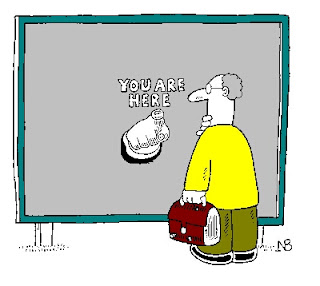
People usually don't like caricatures (especially those who are caricatured!), but sometimes they are useful to sketch quickly and efficiently a situation and highlight a problem to solve. So let’s try to caricaturize neogeography, one hot topic of the moment, in order to uncover interesting challenges … (and of course no offense to anybody, neo- or paleo :-) ).
Let’s assume Mr.X. He’s neogeographer: he’s young, freshly shaved, technologically ultra-literate and he’s convinced that the Internet is nothing less than the nervous system of the planet. He likes mashups, he likes mapping APIs, and he considers that the wisdom of the crowds provides him with any information he would really needs (‘if it’s not on Twitter, it doesn’t exist’, he uses to say). He makes pretty beautiful maps; usually, they are not very useful, but so appealing!
And then comes Mr.Y, the paleogeographer, with a grey beard and an outdated desktop GIS package. He trusts only data he has paid for (so that there is a written trace of the provider’s liability), and carefully references in a proper metadata record the information he derives from his sophisticated geoprocessing scripts(he has a thousands of scripts written in an obscure language, that can derive everything he needs to know about the planet earth). Using his trusted data and models, he provides scientific evidence that nobody would dare to discuss on. The paper maps he produces are often ugly and outdated, ‘but at least they’re 100% right’, he uses to say.
The thing is that Mr.X will most likely never extract some real meaning of the extraordinary mass of information he’s playing with. And Mr.Y will never make he’s great models benefit from this abundant mass of geo-information Internet can provide. So now, OK, I told you it was a caricature and this statement can appear exaggerated, but here’s my point: I would like to see more added value to geodata out there (who rememers useful concepts like ‘feature overlay analysis’, ‘density’, ‘proximity’, ‘map algebra’, etc.?) and I would like to see geodata provided by non-specialists (i.e. Volunteered Geographic Information – or VGI ) more often considered as a novel source of information for our earth monitoring processes.
Building bridges between casual- and expert geography, this was the (wide, wide picture of) the motivation behind the paper I presented last June in GSDI11 conference. The idea was: if we can assess ‘how vague’ is the information provided by citizen when acting as geo-sensors, it’s a good start to use this data ‘for what it is’, recognising its value but also its limits and build some robust quality control procedures on top of it. The underlying topic of fuzzy geography is not new at all; some eminent scientists worked on it since decades. But maybe it worth it to re-examine it with a fresh perspective, like a neographer would hopefully do …

Hi, de Longueville
ReplyDeleteThis is a nice article to stimulate readers to think about how ambiguty in VGI and how difficult to handle it. I'm gald to see we're working on the similar issue on VGI or Web 2.0. We met in ACM LBSN 2009 in Seattle. My paper is to extract place concepts from Flicker tags. Unfortunately, we didn't talk more each other in LBSN. I hope I have some opportunities to discuss with in the near future.
In fact, we have paper that is also discussing about the gap in between amateur and professional users of geospatial inforamtion. The paper was published on a workshop in AGILE 2007. http://musil.uni-muenster.de/wp-content/files/agileworkshop/Lemmens_Deng-CarifyingTheMeaningOfSpatialFeatures.pdf